

Nature and History in Rhodes: Ancient Sites, Sacred Hills and Hidden Landscapes
Table of Contents
Nature and history in Rhodes are rarely separate
Nature and history in Rhodes are not two different ways to explore the island. They often appear in the same place. A hilltop is not only a viewpoint; it may once have been a sacred site. A shaded valley is not only a cool escape from the heat; it may explain how inland routes, water and settlement shaped the island.
Even the coastline is not simply scenery. In Rhodes, the sea, hills, springs and forests help explain why ancient cities were built where they were, why fortifications faced certain directions, and why some places still feel important before you know their full story.
That is what makes a nature-focused day in Rhodes more interesting than a simple break from beaches or sightseeing. The landscape is part of the island’s memory. Once you start reading it this way, Rhodes feels less like a sequence of attractions and more like a connected historical terrain.
Why the landscape mattered in ancient Rhodes
Before roads, cars and modern resorts changed the way people moved around the island, geography mattered more directly. Settlements needed access to water, cultivable land, safe anchorages, defensible hills and visible routes across the sea. Religious sites often occupied high places, not only because they were dramatic, but because height made a place visible and symbolically powerful.
This is why so many historic places in Rhodes make more sense when you look at the land around them. The acropolis at Lindos rises from a rock above the sea. Ancient Kameiros spreads across terraces facing the west coast. Filerimos watches over the northwestern side of the island. Monte Smith, above modern Rhodes Town, shows how the ancient city was arranged in relation to slope, view and open space.
Filerimos — a sacred hill above the northwest coast
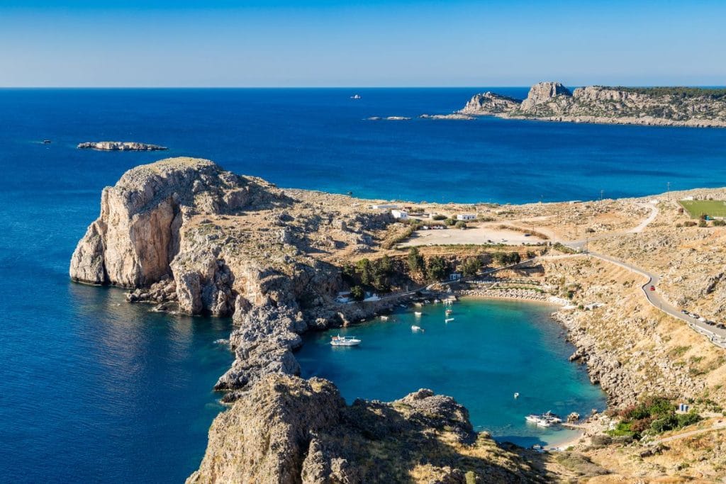
Filerimos is one of the clearest places to understand nature and history in Rhodes together. The hill rises above the northwestern coast, close to the area associated with ancient Ialyssos, one of the island’s three old city-states. The first impression is natural: pine trees, wide views, cooler air and a slower rhythm than the coast below. But the hill is not simply a scenic stop.
Its height gave it importance. From here, the landscape opens toward the sea, the plains and the northern edge of Rhodes. Over time, layers of worship and occupation gathered on the site, from ancient associations to later Christian and medieval presence. That continuity matters. Filerimos shows how certain natural places remain meaningful across different periods because the land itself gives them presence.
Lindos — the acropolis that explains its own location
Lindos is often described through its white village, narrow lanes and postcard views. Those details are real, but they do not fully explain why Lindos became one of the island’s most important ancient settlements. The answer is partly in the landscape. The acropolis rises from a steep rock above the sea, naturally protected and highly visible. Below it, the coastline offered access to maritime routes, while the elevated sanctuary created a powerful religious and civic landmark.
Walking up toward the acropolis is not only a climb to a monument. It is a way of understanding how ancient communities used height, visibility and coastline together. The Temple of Athena Lindia, the later fortifications and the village below all belong to different periods, but the rock explains why the site mattered in the first place.
Kameiros — an ancient city shaped by land and water
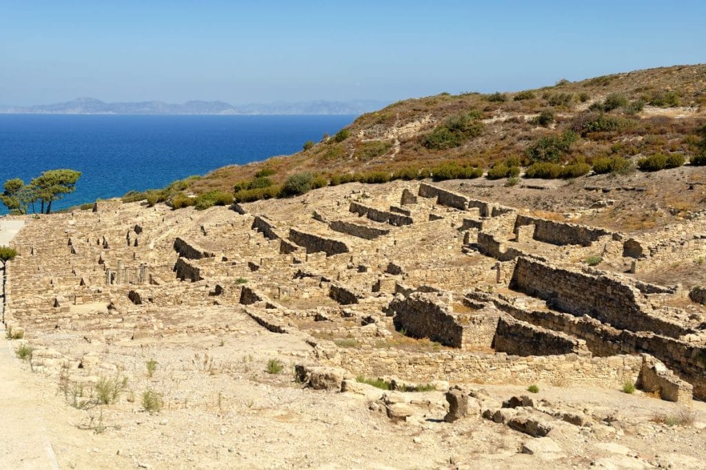
Ancient Kameiros has a quieter presence than Lindos, but it is one of the best places to see how settlement followed the logic of terrain. The city was built on a sloping site, with terraces descending through domestic, civic and sacred spaces. Its position on the west side of Rhodes connected it to agricultural land and maritime routes, while its layout shows careful adaptation to the natural slope.
The most interesting thing about Kameiros is that it does not need dramatic reconstruction to be meaningful. The street lines, open spaces, cisterns and terraces allow visitors to imagine a city shaped by practical needs: water storage, movement, food production, worship and visibility. It is archaeology that still feels tied to the land beneath it.
Monte Smith — ancient Rhodes above the modern city
Monte Smith is close enough to Rhodes Town to be easy to overlook, but it offers one of the most useful introductions to ancient Rhodes. The remains of the ancient acropolis, stadium and temple area sit above the modern city, with views toward the sea and the urban fabric below. This is not a remote archaeological site; it is a reminder that the modern city grew beside and over older layers.
The value of Monte Smith is partly in that contrast. You can stand near ancient remains and still feel the present-day city around you. For visitors interested in nature and history in Rhodes, it shows how topography, civic life and public space were connected in the ancient capital.
Seven Springs — water, shade and inland movement
Seven Springs is not an archaeological site in the same way as Lindos, Kameiros or Monte Smith. Its importance is different. It shows why water and shade matter so much on a Mediterranean island. In the heat of summer, a place with running water, trees and cooler air immediately feels valuable. That value would have been even clearer in earlier periods, when inland routes, agriculture and daily movement depended more directly on natural resources.
For modern visitors, Seven Springs works best when it is treated as a landscape rather than a box to tick. The sound of water, the tree cover and the slower pace help explain why natural refuges have always mattered in Rhodes. It is a good reminder that the island’s history was not built only in ports and castles, but also around springs, paths and cultivable land.
Butterfly Valley — a natural refuge that asks for quiet
Butterfly Valley belongs to a more recent kind of visitor history. It is known primarily as a natural habitat, especially associated with the seasonal presence of butterflies, but the experience is still connected to the wider story of how people approach the island’s landscapes. Some places in Rhodes invite movement and noise; this one asks for restraint.
That makes it useful in a nature and history itinerary, even if its historical significance is not ancient or monumental. It shows a different relationship with place: observation rather than conquest, quiet movement rather than sightseeing speed. For families, couples or slower travelers, it can balance the heavier historical sites with a softer experience of the island.
Farma of Rhodes and the changing meaning of rural nature
Rural nature in Rhodes is not only about untouched wilderness. Much of the island’s interior has long been shaped by agriculture, animals, village life and seasonal rhythms. Places connected with local fauna, small farms or countryside routes help visitors understand that the natural landscape was also a working landscape.
This matters because travel often separates “history” from “nature” too neatly. In reality, people lived with animals, fields, orchards, water sources and paths every day. A rural stop can make the island feel less like a collection of monuments and more like a place where landscape and daily life have always been connected.
Why ancient sites in Rhodes were built where they were
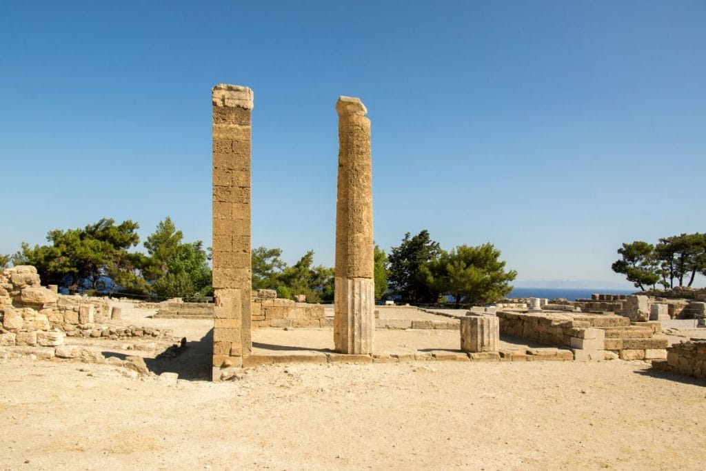
The repeated pattern across Rhodes is not accidental. Historic sites tend to appear where the landscape offered something useful or symbolic. High ground gave visibility and protection. Sea access supported trade, movement and communication. Springs and fertile land supported settlement. Forested or shaded areas offered refuge, resources and routes through the island.
This is the key to understanding nature and history in Rhodes: the scenery is not background. It is part of the explanation. A visitor who notices the slope, the wind, the water and the view will usually understand the historical site more deeply than someone who only reads the name on a sign.
How to explore Rhodes’ historic landscapes without rushing them
The best way to approach these places is to avoid treating them as separate stops on a checklist. A nature-and-history day in Rhodes works better when it follows a clear rhythm: one major archaeological or historical site, one quieter natural landscape, and enough time between them to notice how the terrain changes.
Early morning is usually better for exposed sites such as Lindos, Kameiros or Monte Smith, especially in summer. Shaded or greener places, such as Seven Springs or Butterfly Valley, can work well later in the day, although they still deserve unhurried time. Comfortable shoes, water and a slower pace make a real difference. These landscapes reveal more when they are not treated like photo stops.
This is also where a carefully planned route can help. Not because every moment needs to be organized, but because the distances across Rhodes can make the day feel scattered if the order is wrong. When the route follows geography rather than random attraction names, the island begins to make sense.
Rhodes is best understood through its terrain
Rhodes is often introduced through its famous names: Old Town, Lindos, the Knights, beaches, villages, cruises. But beneath those names is the physical island itself: hills, bays, springs, forests, slopes and coastlines. The more you notice that terrain, the easier it becomes to understand why people built, worshipped, traded, defended and settled where they did.
That is the real value of exploring nature and history in Rhodes together. It turns the island from a list of places into a landscape with reasons behind it.